“Community Mapping Campaign” in California Neighborhood

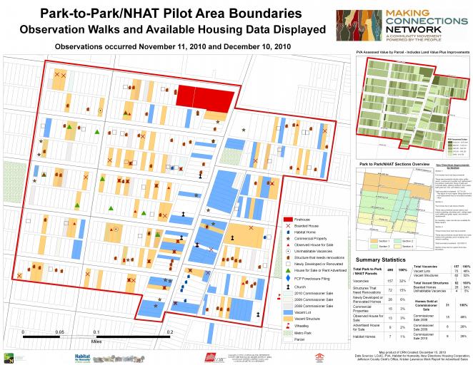
Collected data in a study area within the California neighborhood using property evaluation forms that our team created. We noted condition of housing, vacant housing and vacant lots. We mapped the study area in ArcMap and layered our observed data with data sets we already had. The map is presented in PDF format to show the many layers of data that has been collected. So far, this map has been presented to California community groups and partners of the organization. Our next step for this mapping project will be to collect qualitative data from residents living in the study area and then present the map to them. Feedback from the residents will then determine our next steps. Because of the interest received from our presentations of this data, we are planning on doing this same project in sections of Shawnee and Park Hill neighborhoods in Louisville.
